SBRI Briefing in the Assembly today

That this Assembly calls upon the Executive to actively promote and raise awareness and understanding of the Small Business Research Initiative (SBRI) across the public sector; and further calls upon the Executive to put in place appropriate measures to increase uptake of the SBRI by Departments and the wider public sector to help stimulate and … Continue reading “SBRI Briefing in the Assembly today”

That this Assembly calls upon the Executive to actively promote and raise awareness and understanding of the Small Business Research Initiative (SBRI) across the public sector; and further calls upon the Executive to put in place appropriate measures to increase uptake of the SBRI by Departments and the wider public sector to help stimulate and drive innovation, especially in local micro-businesses and small and medium-sized enterprises.

SBRI is, in my opinion, possibly the most important tool for government to support small businesses in Northern Ireland. Northern Ireland is 98% small to medium enterprises, and 95% micro-businesses. Yet, the very people who provide the bulk of the private sector get the least assistance.

You see, it’s not funding, it’s procurement. It’s not a grant, it’s a purchase order. And it also neatly solves the problem of government not getting what they want out of the current procurement jungle (though they get what they ask for, to all our detriment).

There’s Digital Hubs and digital hubs.

There is an inevitability of a concentration on the digital knowledge economy for Northern Ireland. We have a thriving group of developers and designers in Belfast, a huge amount of ambition in the North West and a heap of activity building in the Southern and Western counties of the province. Last week I went to … Continue reading “There’s Digital Hubs and digital hubs.”

There is an inevitability of a concentration on the digital knowledge economy for Northern Ireland. We have a thriving group of developers and designers in Belfast, a huge amount of ambition in the North West and a heap of activity building in the Southern and Western counties of the province.

Last week I went to the Digital Hub along with Momentum, Belfast City Council, InvestNI and representatives from DCAL and OFMDFM.

We heard the spiel about how it brought some regeneration to the area, that they still have a considerable subvention from the government after 10 years (less than €2m a year, but overall investment has been around €30m since inception and may not include transferred assets).

I also spoke to some of the guys in some of the businesses. They said they wish the Hub was one mile closer to the city centre, that the reason they use bikes and public transport is because they don’t want to bring their cars to that area of town and even the big lads feel a little concerned leaving the Hub with a laptop.

It re-iterates my belief that a city centre location for a Belfast Hub is essential. Not least because Davy Sims put together a map of Digital Media companies in Northern Ireland back in February of 2010 and discovered most were within a square mile in the city centre.


View Belfast Media Square Mile in a larger map

I don’t think we want a straight property play like the Hub in Dublin. We’re a small region with a big ambition so we have to think much more strategically about what goes where. We also need to be 100% joined up. I think I have the support of the Digital Circle steering group in my opinions and in my vision for a digital hub-type infrastructure in Northern Ireland. It’s a big plan, an ambitious plan, even an audacious plan and if it delivers, it will bring the concept to the province as a whole rather than just to a small region.

Location: it’s a feature, not a bug

Apple came under fire this week as it was revealed (by a research paper dating back to 2010) that a file is created and maintained on the iOS system which contains location data for every time you have queried location services. For me, as you can see from previous posts), it presented a way to … Continue reading “Location: it’s a feature, not a bug”

Apple came under fire this week as it was revealed (by a research paper dating back to 2010) that a file is created and maintained on the iOS system which contains location data for every time you have queried location services. For me, as you can see from previous posts), it presented a way to map my movements. No big deal as you can also see, I publish my movements live on Latitude.

At no point is it true (at the moment) that this location data is sent anywhere. It is stored on your phone so if you lose your phone to a wily thief who cares where you drink coffee more than he or she cares about your contacts database, browser history, cookies and access to your email, then you may be in trouble. But it’s not stopped quite a few journalists from making the accusation that Apple knows where you’ve been and is obviously using this to beef up iAds or something even more sinister!

It turns out that Android does the same – the difference being that they only store the last 50 entries. This is entirely sensible and highlights an error in the way Apple was handling this data. It’s not clear whether this data is transmitted to Google (and with their recent history, it would not surprise me) but we should probably wait until it’s confirmed. A sceptic might suggest that Google only stores the last 50 entries on device because it uploads them to their secret Texan datacentre constantly anyway but I’ll not accuse here.

The bottom line is that Google is handling the caching of the data correctly and Apple is not. But it makes me really want desktop and mobile apps for visualising my location data over time and having this as an opt-in service or better still ‘an app’ is obviously what I want. Latitude does a half-assed job of recording and a worse job of reporting and it’s the reports that I’m interested in. I want to see where I go. At what speeds.

So where are the apps that really do Location well?

Upset the Apple cart

André Torrez writes why he will buy an iPad this weekend: “If VHS home recording is made legal then our industry is ruined.” “If CD quality music is allowed to be sold then our industry is ruined.” “If DAT is made legal then our industry is ruined.” “If the Rio PMP3000 is allowed to be … Continue reading “Upset the Apple cart”

André Torrez writes why he will buy an iPad this weekend:

“If VHS home recording is made legal then our industry is ruined.”
“If CD quality music is allowed to be sold then our industry is ruined.”
“If DAT is made legal then our industry is ruined.”
“If the Rio PMP3000 is allowed to be sold then our industry is ruined.”
“If file sharing is permitted then our industry is ruined.”

The tactic is as old as the hills and used by some pretty dishonest people in the last few years to combat technology they feared would upset the nice apple cart they’d set up.

I don’t think this is justification enough to buy an iPad but it is justification for citizens of the United Kingdom to oppose the Digital Economy Bill. I support copyright, of course I do, but copyright is a human invention and the acceleration of human innovation is now hidebound by laws enacted when technology was in its infancy. Corporate interests now keep our writers’ works bound in law for 75 years after their death even when they have no descendants (I have a personal bet that copyright laws will be extended again in the UK before the end of 2012 – mark my words!). Wake up people – we’re being robbed of our heritage. In the olden days, we were DRM-free. We easily copied materials between us and making a living as an artist was fraught with peril. Copyright was introduced to help that and it helps artists make a living even when their creations are copied. But there has to be a sensible limit – it’s not meant to be in perpetuity. When you create something, when you have a performance, it’s not meant to secure an income for the entire length of your life and the length of life of your descendants. Let them create something too! Copyright, designed to protect the incomes of artists, ends up stifling artists because they lose one of their incentives to create, put simply: hunger

Here in the UK, we’re going to be paying 50 pence a month additional tax to fund an initiative which will put 2 Mbps broadband into every home in the nation. While I applaud the plan, I have grave concerns over how it has been thought through. Supplying broadband is part of the puzzle – what about the hardware to run it on? What about the electricity to power it? Will this empower or destroy smaller internet service providers?

But more importantly – what are the social implications of this. Just as there are naysayers who don’t think the iPad is a viable (let alone well executed) device and cannot see past their blinkers on what their definition of a mobile computing device is, there are similar limitations on what is possible with broadband for all. Will this broadband be delivered by a provider who gives set-top boxes to everyone which run a cut down thin client? Will the browser included be standards compliant? (I was present at a recent presentation to Belfast City Council where a solution was being offered for set-top boxes which would put everyone’s browser a version behind the current, control access to Facebook and Youtube, force Council-related advertising and was prepared to offer “Secure by Design, because it’s Ethernet”. Now, as a once-techie I have no fucking idea what that last bullet point was meant to mean but to be honest I’d already switched off from the presentation long before that porky-pie and considered it a very bad idea.

There is no way that the UK is ready for a 100% broadband uptake either in terms of social capability or technical ability. We need more than just lines into houses – we need social reform, we need the government to take charge and not be so lily-livered about “new” media. We need them to open their doors and allow complete transparency. Then, after all of that, maybe then we’ll be ready for everyone to be online.

So, about that game company…

It’s been an exciting week. On Tuesday morning I met with Leo Galway, John Girvin, Conor McCluskey, Darin Smyth and Christian McGilloway regarding the formation of a local ‘games development cluster’. Everyone seemed to think it was a good idea and so now we’re looking for a good brand to help identify the cluster. This … Continue reading “So, about that game company…”

It’s been an exciting week.

On Tuesday morning I met with Leo Galway, John Girvin, Conor McCluskey, Darin Smyth and Christian McGilloway regarding the formation of a local ‘games development cluster’. Everyone seemed to think it was a good idea and so now we’re looking for a good brand to help identify the cluster.

This coming week (Thursday 25th March) I’ve organised an event with Belfast Metropolitan College called “INGAGE” which stands for “Innovation in Gaming in Education”. We’ve got an engaging calendar planned out for the day.

During the academic year 2009-2010, Belfast Metropolitan College, supported by Digital Circle and the Department of Employment and Learning, introduced a new extracurricular games development ‘club’ for students taking the games design courses at the college.

This event will serve to highlight the work undertaken by the students in the ‘l33t Creations’ club as well as highlight some work being done by other creatives in the games industry in Northern Ireland.

AGENDA

10.00 am Arrival / Registration
10.30 am BMC Welcome Trevor Smyth
10.40 am Welcome & Overview of Project
Darin Smyth / Christian McGilloway
11.00 am Guest Speaker Greg Maguire
Q & A
12.00 pm Demos
Lunch
1.00 pm Guest Speakers
Straandlooper
Mark Cullen
Brendan McGoran
2.00 pm Closing remarks – Reid Lynas

Attendance is free and refreshments will be provided. Local companies wishing to network are welcome. But you have to RSVP!

And lastly, but not least, I’ve been working on the UI for the game I mentioned the other day.

IMG_0937

I’ve spent this evening documenting the Touch Events which will need to be plugged into Unity3D. It’s my job to document the UI, then to write the story and do the research.

I’m still trying to think of a name for the games company (though I have some ideas) and I’m putting together a team of people who can actually manage to pull this together. I provide the ideas – it’s others who will provide the implementation in many ways.

Anyone want to help?

Using the GeoTags in Twitter

I have an idea for an app or a web site or something. In theory it seems easy and I’m hoping a celever friend or two will help me figure out the detail. Essentially, it’s going to make use of this: curl http://search.twitter.com/search.atom?q=from%3Ausername | grep georss where you replace ‘username’ with a Twitter ID. The … Continue reading “Using the GeoTags in Twitter”

I have an idea for an app or a web site or something. In theory it seems easy and I’m hoping a celever friend or two will help me figure out the detail.

Essentially, it’s going to make use of this:
curl http://search.twitter.com/search.atom?q=from%3Ausername | grep georss

where you replace ‘username’ with a Twitter ID. The account has to have geotagging enabled.

You can also see geotagged Tweets using this command:

curl http://search.twitter.com/search.atom?geocode=54.66%2C-5.65%2C5km

This does much the same thing but shows you tweets specified by a particular geotag.

I’m not a programmer, not yet. But I’m going to pursue this as a demo app. The visuals I have ….uh…visualised… are kinda cool.

Ten Apps I Want…

Ten Apps that I’d like to see on the iPhone. I’m also suggesting names for these. To be honest, I’d like to pull together a team to build them but that seems to be a lot more difficult than I’d hoped. If anyone wants to call me and work with me to pull together funding, … Continue reading “Ten Apps I Want…”

Ten Apps that I’d like to see on the iPhone. I’m also suggesting names for these. To be honest, I’d like to pull together a team to build them but that seems to be a lot more difficult than I’d hoped. If anyone wants to call me and work with me to pull together funding, then you know where to get me.

  1. MeetFreak/TrendSeek
    Helps people find each other by abusing Twitter trends and trying to suck Location Data in there. This is a lot easier now that Twitter is supporting GeoTags. So, let us see a map of trends? People are talking about #RED, where are they talking about it? Let us see every tweet with the Trend on a map that we can see. Then you’re more likely to be able to congregate with people
  2. Multitool
    Uses the five tabs along the bottom to give you a view of
    1) IMAP account
    2) Web Browser
    3) Twitter
    4) Mapper
    5) Converter/Calculator
    Redirects all http:// and mailto: seen inside the app, to the app and not outside so doesn’t launch Safari or Mail. A lot of this is kinda redundant when we have decent clients for much of this inside Safari. But some offline caching is a big deal for those of us who tend not to be inside the city centres where you can get decent 3G.
  3. Screen shot 2009-12-01 at 11.32.12

  4. Verifriend, Reputato
    This is an online reputation profiler. Yes, it’s going to be a popularity contest but essentially it all depends on trust. Adding your rating to someone is not something to be done lightly. In some ways it needs to be a trust engine – and it can be as simple as giving a trust rating to a new friend based on the trust ratings that others have provided. There needs to be some sort of anonymity (maybe like the reviews process on iTunes you only get a rating when a certain number of reviews have been processed) but unlike FaceBook it should provide that extra level of security.
  5. Screen shot 2009-12-01 at 11.30.26

  6. Director
    Allows me to text directions to someone who asks me on the street. In plain text. Or Bluetooth them. Or even just email them. Or something. Or magic them straight into their brain. Any of these things would be fine. Just so I don’t have to try to explain the directions to someone.
  7. REDACTED
    This one was so good, someone asked me to take it down. 🙂 Suffice to say it was AR related.
  8. Tweet16
    Twitter lists are all very well but they don’t solve th problem I have. I follow about 1000 people but there’s probably less than 150 or so (that magic Dunbar number) whom I regularly interact with. There’s probably only 10% of those whom I really want to pay attention to. I’d like a Twitter client that shows me my timeline, my mentions, my DMs and finally, my Tweet16 – 16 people from whom I see all of their public messages rather than not seeing the ones who are at people I don’t follow.
  9. Plannity
    So, I fill in all of this information into my calendar and that includes times and dates and, most crucially, locations of my meetings. Why hasn’t there been a social app that runs via Exchange/Outlook, on iPhone, iCal and other formats which takes this location information, munges it up with my social network and allows me to see when I can grab lunch with friends or when I’m in the same town as someone I like. I think that Tripit is meant to do this and today I read about Plancast which promises to do something about this. But this is a hot topic, guys. Location is the big thing for 2009/2010.
  10. Echelon (or TwitterBug)
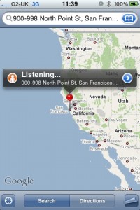
    I mentioned this a week ago – a cool idea for Twitter and other social networks which again uses location. So – get this – all of your messages are geotagged, or if not now, a lot of them will be. So, Echelon ‘listens’ in for anything said in an area rather than things said about trends or by your friends. The default set is seeing tweets which are in your immediate area – the killer part though is being able to drop a ‘bug’ (for bug, read ‘pin’) on a map and be able to sample the Tweets going through that area and the surrounding radius. So, in effect, you’ve dropped a Twitter Bug somewhere and you’re able to listen in. The Freemium version could monitor one location, the PayFor version could monitor several. ( ECHELON is a name used in global media and in popular culture to describe a signals intelligence (SIGINT) collection and analysis network operated on behalf of the five signatory states to the UK-USA Security Agreement (Australia, Canada, New Zealand, the United Kingdom, and the United States)
  11. photo

  12. The Official CIA Manual of Trickery and Deception
    Perfect for the Sandbagger or Spook among us, this is a recently published book derived from an official manual. As most of them are small pictorial sessions, they’re ripe for viewing on the iPhone, turning the iPhone into the ultimate tradecraft manual. You can see clips from the book on Gizmodo. So scan it, make it searchable so you can quickly flick through and find the perfect tradecraft for the perfect moment.
  13. Pollenator
    For public debates, a simple push notification which opens the app and gives you a simple couple of choices accompanied with text, audio or video. Push one, it’s recorded (with time, place, ID, IMEI and whatever other data you have collected and after a certain amount of time, the poll times out. Poll answers should be “Yes”, “No” or “Whatever”. If you choose to ignore or “Whatever” it, then you’re counted as an abstention. I’d love to see this app running and see visualisations of what it could bring in terms of demographics, location and other meta data. I sat with Stuart and Phil (and with PJ on the end of a Skype call) one evening and we mocked up some stuff for this based on Stuarts idea of “Pirates versus Ninjas”. But the actual implementation could have led to entirely other applications.
  14. Polls widget from Google Wave
    Polls widget from Google Wave

I’d love to see all of these on my iPhone. Id love to talk more about these apps to people who are interested. I’d love even more to be involved in the group/company/whatever that was going to make some of these.

Please comment if they inspired you or if you’re working on something similar.

Location-aware OpenGov & Crowdsourced Data

I’ve been reading a lot about OpenStreetMap because, for many reasons, travel is something that I’m intending to do a lot more of. Using your Maps app on your SmartPhone when in a foreign country is just a license for your carrier to print money. When you consider the amount of data transmitted it’s evident … Continue reading “Location-aware OpenGov & Crowdsourced Data”

I’ve been reading a lot about OpenStreetMap because, for many reasons, travel is something that I’m intending to do a lot more of.

Using your Maps app on your SmartPhone when in a foreign country is just a license for your carrier to print money. When you consider the amount of data transmitted it’s evident that until roaming costs are brought under control. there’s no sense in using online maps when travelling. Which kinda defeats the purpose.

So, OpenStreetMap, if you download the maps (something that you cannot do with Google Maps) seems to be a much more sensible proposition especially now that storage on SmartPhones is getting to the point that this becomes practical.

So, is a map enough?

Of course it is. But where things become interesting is when you combine them with other sources of data. Such as the newly opened data we’re getting out of OpenDataNI or some of the data which is available from NISRA (though the latter seems all embedded in PDF and not raw data at all).

This sort of ‘real life’ data is of immense interest, if people realise they can ask for it.

What about a location-aware app that:

  • stays open and records one set of location data every minute. What’s the interest there? It tells you where the fast and slow bits of the roads system are. Collate this data with a hundred other users across the province (never mind any other country) and you’ll generate an instant map of where the traffic snarl-ups are. Make it so that you can shift through the data according to time of day and you’ve got the basics of a route planner that will help you see traffic trends ahead. That’s much more useful than having someone sit and count cars all day at a junction.
  • stays open and records any bumps and jolts in the roads system using the built in accelerometer that comes with every new SmartPhone. Built in a threshold value and send any data that exceeds this up to the server. You’ll have to take into account the driver hitting the kerb or the iPhone dropping out of it’s holder but those should be outlying data points – what you’ll get is a bump map (or more accurately, a pothole map) of the province. So you can either avoid those roads or ask your local politician why this has gotten so bad and not been fixed.
  • permits the average citizen to report civil issues such as vandalism, broken kerbstones, potholes, non-functional streetmaps, illegal dumping or other civic issues. They take a photo, maybe add an audio report or text tag and the data is sent up to a server. Combine them into a map and look for which councils have the most issues. Offer the data to the councils to help them find the issues that plague them. Keep a report open on which councils respond better.
  • listens for keywords that a driver may shout. And we can see which parts of the road and which times of the day frustrate the most drivers. Yes, it’s a simplistic measure of Road Rage but a relatively cathartic one. Maybe the DoE Roads Service can focus on those areas with the most reports and see what they can do to alleviate it. It’s not always going to be other drivers.
  • gives you some advance warning of roadworks? There must be a database of this somewhere within the Roads Service – the question is how to get that data. And have the app do it’s own reporting so we can crowdsource what data we can’t get from official sources. I’d certainly be interested in seeing the difference between reported roadworks and planned roadworks – I’d expect there to be none?
  • tells you where the nearest taxi is and gives you an indication of it’s availability. All Taxi companies install GPS units in their taxis – we just want to know who is available and close so we can get a taxi quick. On the taxi front, why is there not an easy lookup for the new Taxi plates so we can type in the taxi number (or God forbid, photograph it) and be quickly given back the Registration plate it belongs to along with a photo of the taxi driver meant to be driving it.
    Green Taxi Plate

    That would give me heaps more confidence in the system. I don’t want to know his name, how many kids he has or whether he’s got a Microbiology degree – I just want to know if he’s who he says he is. Anyone can stick up a coloured plate.
  • tells you where your nearest bus stop is and tells you where the next bus to that stop is, where it’s going and it’s estimated time of arrival. Every bus has a GPS sender in it so we know the data is available. And we’d need access to the timetables as well. It would mean having useful data on when we’d need to leave the office to get a certain bus whether that bus is delayed or whether we should run for the train instead. Whether or not this be expanded to include reporting of cleanliness or vandalism or even just reporting exactly how late the bus was is up for debate.
  • gives you the approximate location of the flight your gran is on so you can choose not to wait in the expensive car park and go have a coffee somewhere that doesn’t cost an arm and a leg. Tie that in with the flights timetables and we’re laughing. (Today we were picking a friend up from Belfast City Airport. And the flight was diverted to the International. BCA did not know. It landed safely. BCA did not know. In fact, they had no information at all on what it was doing.)
  • shows you examples of urban archaeology. There are thousands of pictures out there showing what the city looked like ten years ago, fifty years ago, a hundred years ago. Why not use a street map to provide a ‘historical Street View’ so we can see what buildings used to look like, what traffic used to pass here and view landmarks which have long since disappeared.
  • provides a glimpse into the future. I think there’s real potential for architects and city planners to get out of their micro-models and into the real world and use these devices to help visualise what buildings will look like in situ. I’d reckon if that had been done down near the Waterfront, we’d not see the Waterfront hidden by architecture that comes from the breeze block era. It’s a beautiful building. Surrounded by horrors.
    image.aspx
  • shows you all of the tourism events happening today in a visual form. Drag a slider or swipe over to 11 am and see what’s on where. Drag again to 2:30 and see what’s going on there. Community groups and Tourism agencies should be all over this.

The information context we need on all of this is location and time. Without both of these, there’s not enough context to make them truly useful.

We’d need everyone in every country to be using apps like this so there’s definitely an Export potential and a method of getting the information in there. These sorts of apps would be incredibly suitable for the “Mobile Apps Challenge” that is being organised by Digital Circle and Momentum, details of which will be forthcoming once sponsors are confirmed.

All of this becomes extremely exciting when you start looking at the apps which are driving AR to the top of the Hype Curve but even without AR, this is useful stuff.

Augmented Reality Soundbites

I’m watching this: Video: Bruce Sterling’s Keynote – At the Dawn of the Augmented Reality Industry from Maarten Lens-FitzGerald on Vimeo. The keynote is something to watch I guess but on that host page scroll down for some of the soundbites. “Is there an Augmented Reality system for building Augmented Reality systems?” “You are going … Continue reading “Augmented Reality Soundbites”

I’m watching this:

Video: Bruce Sterling’s Keynote – At the Dawn of the Augmented Reality Industry from Maarten Lens-FitzGerald on Vimeo.

The keynote is something to watch I guess but on that host page scroll down for some of the soundbites.

“Is there an Augmented Reality system for building Augmented Reality systems?”
“You are going to need an industry journal”
“You are going to need an industry code of ethics”
“The majors will buy you out”

These four statements give me most pause.

Open Data

After not travelling long-distance for around 15 years, I found myself in San Francisco twice this year. San Francisco has many similarities to Belfast – a plethora of neighbourhoods, a strong history of civil rights activity and the majority of economic activity being firmly in the ‘S’ part of SME. San Francisco also has an … Continue reading “Open Data”

After not travelling long-distance for around 15 years, I found myself in San Francisco twice this year. San Francisco has many similarities to Belfast – a plethora of neighbourhoods, a strong history of civil rights activity and the majority of economic activity being firmly in the ‘S’ part of SME.

San Francisco also has an initiative to open City data such as crime statistics, restaurant health codes and municipal recycling information. This will be stored at DataSF.org. Northern Ireland’s equivalent is the recently launched OpenDataNI initiaitve.

These efforts are aimed at the citizen as well as the entrepreneur. There’s nothing stopping a smart developer/designer from building and marketing a service that uses open data in a new and interesting way. Whether that’s directing individuals to recycling spots around the city or mixing school and crime data together with a property rental service (something I’m guessing we’ll see coming out of Propertypal judging by some of their recent tweets – smart guys!)

We already have some innovators in this arena and Momentum / Digital Circle is working to foster additional development. I’ve been working to develop the already exciting iPhone development community in Northern Ireland. DevDays in April attracted 155 people and Refresh Belfast last Monday got 90 people through the door focusing on iPhone Design despite a literally last minute venue mishap due to double-booking.

Momentum / Digital Circle are launching a Mobile Application Challenge in the coming weeks. The premise is to get folk out there displaying some of the work they are doing in Mobile Applications (featuring but not limited to iPhone development) and getting them in front of potential investors and also a potential audience. By focusing on the areas of Consumer, Health & Wellbeing, Public Service Value and Enterprise, we’re showing off some of the excellent work that goes on behind closed doors or under license to other companies in other countries. We’re putting together a series of workshops – highlighting design, Connected Health, applications which use the Cellular network and assistance in protection and exploitation of intellectual property.

For open data the possibilities are still yet to be realised and the OpenDataNI staff would love to hear more suggestions on data sources which would benefit the general public. What have we, the public, paid for and yet we don’t have access to?