My Code4Pizza talk from Showcase

Hosted by Switch New Media This is the video stream from my Code4Pizza pitch at Showcase on the 16th September. Allegedly attended by 300 and viewed by up to 600, it detailed some of the work done by some local heroes for the Code4Pizza project. Seventeen minutes. Watch in entirety for a one way ticket … Continue reading “My Code4Pizza talk from Showcase”

Hosted by Switch New Media

This is the video stream from my Code4Pizza pitch at Showcase on the 16th September. Allegedly attended by 300 and viewed by up to 600, it detailed some of the work done by some local heroes for the Code4Pizza project.

Seventeen minutes. Watch in entirety for a one way ticket to Snoozeville.

Northern Ireland GIS Data

Yesterday morning I had the pleasure of being invited to Colby House to meet with various departments within the public sector. Present were individuals from DRD, DETI, NITB, CPD, FSNI and Momentum. The focus of the meeting was the vast services and datasets available from Land & Property Services (the organisation formed from the merger … Continue reading “Northern Ireland GIS Data”

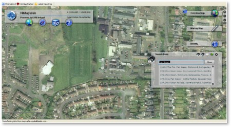
Yesterday morning I had the pleasure of being invited to Colby House to meet with various departments within the public sector. Present were individuals from DRD, DETI, NITB, CPD, FSNI and Momentum. The focus of the meeting was the vast services and datasets available from Land & Property Services (the organisation formed from the merger of Ordnance Survey, Valuations, Rates, Land Register and other departments).

Most government departments have signed up to NIMA (Northern Ireland Mapping Agreement) which is a cross-department funding mechanism where departments get access to mapping data in return for part funding L&PS activities. The biggest users of the data are the emergency services followed by the Department of the Environment. Data accessed right in the cabs of fire engines can guide a vehicle to a car crash located in a field with no other data than just geographical features. It’s also interesting that educational institutions also qualify for NIMA.

The agreement permits access to terabytes of data which is continuously updated both in terms of vector and database information and orthophotography to a maximum resolution of 13 cm. The amount of accompanying data, which can be overlayed, is absolutely incredible – everything from vector locations of every house, details of townlands, address, postal delivery codes and years of historical information as well.

To purchase the data would cost in excess of £500,000 but non-commercial developer licenses are available for £340 per year. L&PS also offer distributor licenses, Value Added Reseller licenses and licenses to third parties (clients of other departments which have signed up to NIMA). The VAR license, in particular, costs a nominal fee, just £1, plus an administration cost to obtain the data and then a royalty license depending on how much value has been added.

Of further interest is upcoming INSPIRE directive from Europe. It describes the depth and format of metadata which must be published to permit standardisation of protocols and data across EU countries. This would permit the meaningful comparison of data such as biodiversity, teenage pregnancy rates, health data between EU states. This would mean that solutions built today would translate forward and be potentially exportable to other EU nations.

Land & Property Services are very interested in talking to industry – individuals and companies who can see compelling uses for GIS data.

The remainder of the meeting was a discussion around the concept of Pre-Commercial Procurement, which is an entire blog post by itself.

Special thanks to Eoin McFadden of the Innovation Policy Unit of DETI for making sure that we got to see that presentation.

In the UK, the default is free and open

David Eaves writes: Yesterday, the United Kingdom made an announcement that radically reformed how it will manage what will become the government’s most important asset in the 21st century: knowledge & information. On the National Archives website, the UK Government made public its new license for managing software, documents and data created by the government. The document … Continue reading “In the UK, the default is free and open”

David Eaves writes:

Yesterday, the United Kingdom made an announcement that radically reformed how it will manage what will become the government’s most important asset in the 21st century: knowledge & information.

On the National Archives website, the UK Government made public its new license for managing software, documents and data created by the government. The document is both far reaching and forward looking. Indeed, I believe this policy may be the boldest and most progressive step taken by a government since the United States decided that documents created by the US government would directly enter the public domain and not be copyrighted.

In almost every aspect the license, the UK government will manage its  “intellectual property” by setting the default to be open and free.

That should read “in most of the UK” because there will be separate discussions held by the devolved departments in Scotland, Wales and Northern Ireland.

I’m happy to say that here in Northern Ireland we not only have some progressive thinkers in terms of the data but also in terms of government procurement of solutions taking advantage of that data.

Our local open data initiatives have been spearheaded by individuals in the DFP and DETI and Code4Pizza is the social working group taking advantage of the data.

Use of OpenData: Icelandic Earthquakes

The last slide in this animation notes that this visualisation was made possible using Open Data. Code4Pizza is the industry-led innovation community focused on Open Data in Northern Ireland. This visualization shows earthquake activity leading up to eruptions in Eyjafjallajökull in South-Iceland in March and April 2010. Each bubble represents a measured earthquake and the … Continue reading “Use of OpenData: Icelandic Earthquakes”

The last slide in this animation notes that this visualisation was made possible using Open Data. Code4Pizza is the industry-led innovation community focused on Open Data in Northern Ireland.

This visualization shows earthquake activity leading up to eruptions in Eyjafjallajökull in South-Iceland in March and April 2010.
Each bubble represents a measured earthquake and the size of the bubble represents its magnitude. Deeper earthquakes are represented with darker colrs while shallow earthquakes are brighter. An earthquake slowly fades out as time passes. Yellow stars indicate eruptions

.

Earthquakes and Eruptions in Iceland 2010 from hjalli on Vimeo.

Source: FlowingData

And again I’m inspired to design a game.

Food for Thought

The title of this blog post is the most accurate description possible. It’s not every day that you are inspired by something, especially not what would be called a “industry move” but sometimes these items can inform you of really cool stuff that is happening out there and that’s where you can find inspiration. I’ve … Continue reading “Food for Thought”

The title of this blog post is the most accurate description possible.

It’s not every day that you are inspired by something, especially not what would be called a “industry move” but sometimes these items can inform you of really cool stuff that is happening out there and that’s where you can find inspiration.

I’ve been playing with Code4Pizza for a while now. Code4Pizza is founded on the idea that people are essentially good – a pretty wacky idea.

codeforpizza is a nonprofit idea to encourage young techies to build their own careers by providing computers, mentoring, internet access, learning materials and pizza. CodeForPizza is initially based in Belfast, Northern Ireland

Now, so far we’ve managed to attract some of the best and brightest of Northern Ireland’s indigenous tech sector and they’ve worked on processing bus and train data with the help of Translink and I’ve been putting together some more projects which are essentially for the public good.

So, what inspired me today?

Former IFP head, Michelle Byrd, has been named co-president of Games for Change, a global advocate for making and supporting digital social impact games. Byrd will serve along with Asi Burak, who recently joined Games for Change as Executive Producer and was previously co-founder of Impact Games, creators of the “PeaceMaker” and “Play the News” platforms. Byrd and Burak will work together on the strategic vision of the organization and will jointly oversee all programmatic initiatives. Byrd will take the lead on institutional relationship and partnership efforts, along with fundraising, business affairs, financial management, and communications strategy, while Burak will take the lead on curation, development, and execution of programs and services “to raise the production, quality and influence of social impact games, and serves as a spokesperson for the organization.”

This organisation, Games For Change, tackles the real world problems of human rights, public health, poverty, the environment, global conflict and the economy.

I started Code4Pizza for similar reasons and my plans for a gaming company are also similar – bringing the impact of designers and developer grey muscle to some of the work needed for lasting social change.

I am somewhat encouraged by the ConDem’s BigSociety ideas

The plans include setting up a Big Society Bank and introducing a national citizen service.
The stated priorities are:

  • Give communities more powers
  • Encourage people to take an active role in their communities
  • Transfer power from central to local government
  • Support co-ops, mutuals, charities and social enterprises
  • Publish government data.

The opposition are obviously opposed and there are fears that it is just a smokescreen for proposed cuts and a swathe of privatisation but the release of government data and the empowering (and presumably funding) of charities, social enterprises and co-operatives is a good thing.

I’m not 100% sure that there will be adequate delivery of this without organisations like Code4Pizza. You need to have a group of folk who are lighting the path for others by creating initial projects to start things off. These pathfinder projects need to have their own impact as well as building a framework for others to participate. You need buy-in from local educational establishments (to provide an unending supply of placement students (across many disciplines) to provide the heavy lifting and also provide themselves with experience and a portfolio which they may choose to bring to an employer or establish their own business.

Food for thought. Code4Pizza feeds people, entertains them for an evening with good company and has a social purpose. It serves to provide a focal point for community development and social engineering. It ticks the boxes of digital inclusion and entrepreneurial spirit. What a bloody brilliant idea. Maybe Martha Lane Fox will come over and talk to us.

I’m toying with the idea now of turning it into a proper social enterprise. I’d like your views. And your help.

Going Live

LiveNet is a project by Mencap to help “children and adults with learning difficulties and their carers to use ICT to improve health and wellbeing, gain access to information, connect with their community and help achieve their full potential” OpenLiveNet aims to involve the wider tech community in Northern Ireland in the production of some … Continue reading “Going Live”

LiveNet is a project by Mencap to help “children and adults with learning difficulties and their carers to use ICT to improve health and wellbeing, gain access to information, connect with their community and help achieve their full potential”

OpenLiveNet aims to involve the wider tech community in Northern Ireland in the production of some of these solutions by providing MenCap with some much needed technical expertise, some development muscle and to provide something of a “many hands” approach to the aims of the project as well as much needed awareness in the wider community.

What’s the end goal here?
The creation of user interfaces and software which are easily learned, provide meaningful feedback and can help provide an improved quality of life for individuals with learning difficulties and their carers. Such as (but not limited to) these:

  1. new models for web-based social network creation, interaction, identity and privacy
  2. mobile apps which will help with development of independence, communication and personal safety
  3. touchscreen applications to help with communication, creativity, learning

This project, plus my interest in the presentations by Jesse Schell at DICE 2010 and Jane McGonigal at TED were a primary influencer in my ideas for Alien Salvage. The company, which I announced a few days ago aims to create experiences which align with much of this – with the additional remit of compelling design for the wider community as well.

For OpenLiveNet we still need some technical experts and development and design brains to help shape the future. There is a commercial angle on this and savvy individuals will be able to see the opportunities here. If you’re interested, enter your details on the OpenLiveNet page or drop me a line.

The first meet-up I plan to hold in July if you’re interested.

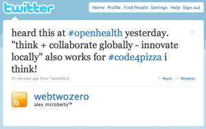
think + collaborate globally – innovate locally

Alex is right to highlight this. We discussed (on Twitter) the merits of open systems (open data, open health, open innovation) and seemed to agree that openness creates opportunity but it requires individuals to provide innovation. Code4Pizza is a local group I’ve started to get folk working on projects which are ‘open’. By open, I … Continue reading “think + collaborate globally – innovate locally”

Screen shot 2010-01-22 at 09.45.13

Alex is right to highlight this. We discussed (on Twitter) the merits of open systems (open data, open health, open innovation) and seemed to agree that openness creates opportunity but it requires individuals to provide innovation.

Code4Pizza is a local group I’ve started to get folk working on projects which are ‘open’. By open, I mean that anyone can contribute, anyone can benefit and as an additional bonus, the projects will generally have a public service value slant. The current project, OpenTranslink, is the result of several months of work by a group of people to get the timetable and route data (most notably, Mark Bennett from the DFP who is part of the team reponsible for OpenDataNI)

Taking the OpenTranslink project as an example. When you travel to a new country, one of the most impenetrable aspects of their culture is their public transport system. This is difficult enough when the native language is not a barrier, but very difficult when the language is different. Nearly every region is developing a suite of apps to run on iPhones, Android phones and Blackberry phones which carries the bulk of their public transport data. I’d wonder – however – if data from other regions shouldn’t be included in “Transport’-type apps.

You innovate with your technology and your design – but from then you just plug regional data into it. Differentiate based on your innovation but you collaborate across regions to provide a seamless experience for the foreign traveller.

In essence – once the clever chaps doing the OpenTranslink data visualisations, API, application logic and interface design are finished, what’s stopping them doing exactly the same for London buses, bus systems in San Francisco, trams in Lyon?

XCake Belfast November

XCake, the local developer group for folk who use XCode had an interesting meeting last night. It was held in the very impressive University of Ulster Belfast campus and was catered for with cake and traybakes by Digital Circle. The first presentation lasted about an hour and detailed the developments in the OneAPI, a GSMA … Continue reading “XCake Belfast November”

XCake, the local developer group for folk who use XCode had an interesting meeting last night. It was held in the very impressive University of Ulster Belfast campus and was catered for with cake and traybakes by Digital Circle.

IMG_0649

The first presentation lasted about an hour and detailed the developments in the OneAPI, a GSMA Reference model for interoperability of network services for telecommunications operators. That’s the long way of saying it’s an easy way for developers to get access to call control, SMS and location services from cell networks. We had three clever folk (Seamus, Richard and Michael) from Aepona who very ably demonstrated the services and answered developer questions. More usefully, however, they were asking the developers about their opinions regarding the use of SOAP and JSON. This is all above me – but it was entertaining to hear the opinions (which were essentially: making XML for SOAP isn’t an issue for most developers but JSON is lighter and simpler).

After that we had a short discussion about our future meeting with Translink, the developments we’ve had with accessing their data and the renewed enthusiasm considering that the Ordnance Survey in Great Britain is opening up it’s 1:10000 map dataset to the public. I hope you’ll join me in encouraging the Ordnance Survey in Northern Ireland to do the same. For what it’s worth, we also have our baleful eye cast in the direction of the Postcodes held by the Royal Mail. At the end of the day if there was government money (our taxes) used to pay for datasets, then I’m determined not to pay for them again.

And we finished with a discussion of future events:

  • An Intro to InterfaceBuilder
  • NimbleKit, PhoneGap and Titanium: do they do what they say or is it all bollocks?
  • Developing for iPhone without InterfaceBuilder
  • Unit Testing for iPhone

We’re kinda unaware of other developer-related events in Belfast but we did mention that Monday night is Demo Night at MobileMondayBelfast.

Code4Pizza: Crowdsourcing Translink

Bob Borchers, who I met back in March of this year (known to most as Mind Mannered iPhone Guy) speaks to Colin Gibbs of GigaOM about Mobile. Bob is now a partner at Opus Capital, an early-stage technology venture firm. Bob will also be speaking at Mobilize. But the place I’m particularly interested in is … Continue reading “Code4Pizza: Crowdsourcing Translink”

Bob Borchers, who I met back in March of this year (known to most as Mind Mannered iPhone Guy) speaks to Colin Gibbs of GigaOM about Mobile.

iphoneguy

Bob is now a partner at Opus Capital, an early-stage technology venture firm. Bob will also be speaking at Mobilize.

But the place I’m particularly interested in is the white spaces — those places between (technologies and industries). That’s where mobile has the potential to take its transformative abilities and implement some changes in long-existing industries or markets. Take health care, for example — in my view, and I think a number of other people’s views, mobile has an interesting role to play in that. Everybody agrees that they want health care delivered more affordably, but at the same or higher quality, and I think mobile has an opportunity to help drive some of those changes.

Also, I think infrastructure is interesting: What are the things the network operators can do to extend coverage, to make backhaul faster, to enable location awareness on networks?

It’s the vertical markets that make Mobile interesting. It’s seeing the ‘humble’ mobile phone being co-opted into new roles. First as a camera, then an email device, then an internet browser, now a games machine and in the future – access to healthcare, public services, education, democracy.

The limited size of these devices means moving as much ‘brains’ as we can into the ‘cloud’. The network operators are able to monitor where you are (using cell towers) so there’s really no need to have an app and GPS burning battery power constantly. With Push messaging and context on your phone there’s reduced need for multitasking as long as the server side is somewhat intelligent.

Tomorrow night we’re putting some of this into practise with a project I dreamed up last year: Code4Pizza.

Code4Pizza is really about directed work. The concept being that you take some developers, you give them a few unsolveable problems and you feed them. By the end of a single evening you should have part of a plan of where to go.

The first unsolveable problem is improving the way we receive information about public transport. In theory, public transport is a more sustainable way to travel. The problem is always going to be communication. There are lots of bits and pieces here but having lists of bus stops, by their longitude and latitude, would seem to be most useful. We have a lot of this data already and we’ve started recruiting people to fill in the blanks. Moving it into the mobile arena where it can be viewed on iPhone, Android, Symbian and indeed any platform with a decent web browser is the main goal. Come along and join us.

(The second unsolveable problem will be in developing a sustainable funding-management application for some local charities. We’re going to be working with the Camphill Community, NICVA and the Open Source Solutions Centre for this. Work to begin soon.)

The long term plan is to have somewhere for the Code4Pizza workers to work. The only requirement is to have something to work on and allow that work to be reviewed by chosen peers and mentors. And in return you’ll get a desk, you’ll get Internet access, you’ll get business mentoring training and you’ll get pizza.

Location-aware OpenGov & Crowdsourced Data

I’ve been reading a lot about OpenStreetMap because, for many reasons, travel is something that I’m intending to do a lot more of. Using your Maps app on your SmartPhone when in a foreign country is just a license for your carrier to print money. When you consider the amount of data transmitted it’s evident … Continue reading “Location-aware OpenGov & Crowdsourced Data”

I’ve been reading a lot about OpenStreetMap because, for many reasons, travel is something that I’m intending to do a lot more of.

Using your Maps app on your SmartPhone when in a foreign country is just a license for your carrier to print money. When you consider the amount of data transmitted it’s evident that until roaming costs are brought under control. there’s no sense in using online maps when travelling. Which kinda defeats the purpose.

So, OpenStreetMap, if you download the maps (something that you cannot do with Google Maps) seems to be a much more sensible proposition especially now that storage on SmartPhones is getting to the point that this becomes practical.

So, is a map enough?

Of course it is. But where things become interesting is when you combine them with other sources of data. Such as the newly opened data we’re getting out of OpenDataNI or some of the data which is available from NISRA (though the latter seems all embedded in PDF and not raw data at all).

This sort of ‘real life’ data is of immense interest, if people realise they can ask for it.

What about a location-aware app that:

  • stays open and records one set of location data every minute. What’s the interest there? It tells you where the fast and slow bits of the roads system are. Collate this data with a hundred other users across the province (never mind any other country) and you’ll generate an instant map of where the traffic snarl-ups are. Make it so that you can shift through the data according to time of day and you’ve got the basics of a route planner that will help you see traffic trends ahead. That’s much more useful than having someone sit and count cars all day at a junction.
  • stays open and records any bumps and jolts in the roads system using the built in accelerometer that comes with every new SmartPhone. Built in a threshold value and send any data that exceeds this up to the server. You’ll have to take into account the driver hitting the kerb or the iPhone dropping out of it’s holder but those should be outlying data points – what you’ll get is a bump map (or more accurately, a pothole map) of the province. So you can either avoid those roads or ask your local politician why this has gotten so bad and not been fixed.
  • permits the average citizen to report civil issues such as vandalism, broken kerbstones, potholes, non-functional streetmaps, illegal dumping or other civic issues. They take a photo, maybe add an audio report or text tag and the data is sent up to a server. Combine them into a map and look for which councils have the most issues. Offer the data to the councils to help them find the issues that plague them. Keep a report open on which councils respond better.
  • listens for keywords that a driver may shout. And we can see which parts of the road and which times of the day frustrate the most drivers. Yes, it’s a simplistic measure of Road Rage but a relatively cathartic one. Maybe the DoE Roads Service can focus on those areas with the most reports and see what they can do to alleviate it. It’s not always going to be other drivers.
  • gives you some advance warning of roadworks? There must be a database of this somewhere within the Roads Service – the question is how to get that data. And have the app do it’s own reporting so we can crowdsource what data we can’t get from official sources. I’d certainly be interested in seeing the difference between reported roadworks and planned roadworks – I’d expect there to be none?
  • tells you where the nearest taxi is and gives you an indication of it’s availability. All Taxi companies install GPS units in their taxis – we just want to know who is available and close so we can get a taxi quick. On the taxi front, why is there not an easy lookup for the new Taxi plates so we can type in the taxi number (or God forbid, photograph it) and be quickly given back the Registration plate it belongs to along with a photo of the taxi driver meant to be driving it.
    Green Taxi Plate

    That would give me heaps more confidence in the system. I don’t want to know his name, how many kids he has or whether he’s got a Microbiology degree – I just want to know if he’s who he says he is. Anyone can stick up a coloured plate.
  • tells you where your nearest bus stop is and tells you where the next bus to that stop is, where it’s going and it’s estimated time of arrival. Every bus has a GPS sender in it so we know the data is available. And we’d need access to the timetables as well. It would mean having useful data on when we’d need to leave the office to get a certain bus whether that bus is delayed or whether we should run for the train instead. Whether or not this be expanded to include reporting of cleanliness or vandalism or even just reporting exactly how late the bus was is up for debate.
  • gives you the approximate location of the flight your gran is on so you can choose not to wait in the expensive car park and go have a coffee somewhere that doesn’t cost an arm and a leg. Tie that in with the flights timetables and we’re laughing. (Today we were picking a friend up from Belfast City Airport. And the flight was diverted to the International. BCA did not know. It landed safely. BCA did not know. In fact, they had no information at all on what it was doing.)
  • shows you examples of urban archaeology. There are thousands of pictures out there showing what the city looked like ten years ago, fifty years ago, a hundred years ago. Why not use a street map to provide a ‘historical Street View’ so we can see what buildings used to look like, what traffic used to pass here and view landmarks which have long since disappeared.
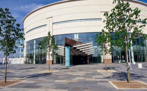
  • provides a glimpse into the future. I think there’s real potential for architects and city planners to get out of their micro-models and into the real world and use these devices to help visualise what buildings will look like in situ. I’d reckon if that had been done down near the Waterfront, we’d not see the Waterfront hidden by architecture that comes from the breeze block era. It’s a beautiful building. Surrounded by horrors.
    image.aspx
  • shows you all of the tourism events happening today in a visual form. Drag a slider or swipe over to 11 am and see what’s on where. Drag again to 2:30 and see what’s going on there. Community groups and Tourism agencies should be all over this.

The information context we need on all of this is location and time. Without both of these, there’s not enough context to make them truly useful.

We’d need everyone in every country to be using apps like this so there’s definitely an Export potential and a method of getting the information in there. These sorts of apps would be incredibly suitable for the “Mobile Apps Challenge” that is being organised by Digital Circle and Momentum, details of which will be forthcoming once sponsors are confirmed.

All of this becomes extremely exciting when you start looking at the apps which are driving AR to the top of the Hype Curve but even without AR, this is useful stuff.